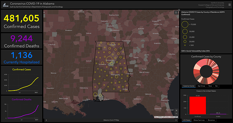
The troubled last year provided unexpected opportunities to demonstrate that geographic information systems (GIS) in general and the cloud-based ArcGIS technology in particular offer tools and data that can inform and enrich virtually any professional field. In the early weeks of the ongoing pandemic, Samford University geography professor Jonathan Fleming used ArcGIS to create a COVID-19 Data Dashboard for the state of Alabama. That site alone has been viewed more than 500,000 times, and it’s only one of many such projects. “The explosion of data dashboards in the COVID era, full of incredible maps and data visualizations, has been largely facilitated by web-GIS technology,” Fleming said. “Now that people have seen so many examples of the power of spatial data, there’s a demand across numerous disciplines for graduates that know how to build these dashboards and other web mapping apps.” To address that demand, Fleming and his Samford geography colleagues have secured campus-wide access to ArcGIS and are actively promoting its use through workshops, lectures and project advising.
ArcGIS is already used extensively in Samford’s geography program, with applications ranging from multimedia StoryMaps produced by students in Jennifer Speights-Binet’s Urban Geography course to the in-depth individual projects of advanced geography majors. The latter work has included Davis Ebbert’s use of drone-collected 3D imagery to assess the suitability of solar panels on Samford’s campus, and Sarah Grumulaitis’ effort to document Birmingham-area food deserts and suggest strategic placement of urban gardens. The department also offers an undergraduate GIS certificate and a graduate certificate in GIS associated with Samford’s environmental management program.
History professor Annie DeVries is among those who have found the technology to be a uniquely rewarding part of teaching and continued scholarly growth. In her case, it has been especially helpful in an ongoing public history project to document the majority African American community of Rosedale, near Samford’s Homewood, Alabama, campus. “The tools that ArcGIS provides are invaluable for continuing our work on the Rosedale Memory Project during a time when we cannot collect oral history interviews in person or do other kinds of in-person community history events,” DeVries said. Last fall she and student researchers Hannah Atchley and Mary Blake Brock used the technology to create a map based on real estate data, probate records and information on how the community has shifted over time due to changes in zoning. The map not only helps document and communicate the history of Rosedale, but also helps inform local officials. “It’s learning a new skill, applying that to historical understanding, and working on creating something that we hope will be useful to the community,” she said.
Community service and social justice are common themes in other ArcGIS projects at the Christian liberal arts university. Students in School of Public Health professor Rachel Casiday’s Water, Wastewater, and Environmental Health course used ArcGIS to map the locations of sewage spill overflows, testing points, and drinking water intakes along the Coosa River watershed as a class project and service activity in association with the Coosa Riverkeeper nonprofit organization. Casiday will also join Moffett & Sanders School of Nursing professor Ellen Buckner in a project to evaluate the effects of school-based health centers on health disparity areas of Birmingham.
Buckner was introduced to the possibilities of the technology through a visit to Samford’s GIS lab, consultation with Fleming, and by learning to use the technology alongside students in her fall Scientific Inquiry course for the University Fellows honors program. “I was specifically there to introduce them to scientific inquiry in a way that was a hands-on, active learning activity where they were dealing with real-world data, and it allowed us to do all of that,” she said.
Buckner’s students, representing multiple academic majors and disciplines, worked remotely in groups to develop interdisciplinary digital projects. The standout project combined a variety of geographic, economic and demographic data to demonstrate the importance of libraries in reducing poverty. That group made a “phenomenal statement,” Buckner said, and her students overall found the course to be a rewarding expansion of their academic horizons. “It was highly effective in both introducing students to science and what’s called ‘big data’ but, more importantly, in a way that was interdisciplinary,” Buckner said. The students expressed appreciation for that aspect of the work in their evaluation of the course. They also said they valued adding practical technological skills to their professional toolkits and collaborating online as COVID-19 limited their physical interaction.
Buckner acknowledged that becoming proficient in ArcGIS is not a matter of pushing a button. She estimated that she and her students needed approximately six weeks to learn the technology and complete projects after Fleming’s introduction. But the results were convincing. “I am really sold on it,” she said. I think it’s a great resource across multiple domains, from faculty-level research to introductory course work. It’s doing everything I want it to do right now.”
Fleming and his colleagues hope Buckner’s experience will become common on a fully geoenabled campus where spatial technology is integrated into learning across every academic division. “The recent implementation of an enterprise sign-in system that provides access to the Samford Geospatial Portal—the largest collection of spatial data in the world and the most powerful GIS software in the industry—is just one step toward making this ambition a reality,” he said.